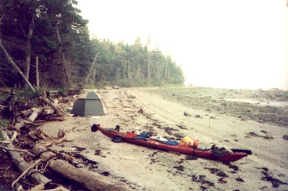
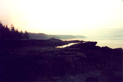
 Picture of the beach I camped on the first night.
August 6th to August 9th, 2001
Monday, August 6th, 9pm
Before leaving I figured it out... from Bangor to Camden was about 55 miles. From Bangor to Bar Harbor would be about 85 miles, and from Camden to Bar Harbor would be about 60 miles. After thinking about these things, I decided I would leave from Bangor again.. to get to know the river better, and get a better idea of average time to get from Bangor to the bay... But because of tide and wind conditions, dad suggested I leave from Bucksport instead. By the time we got down there, the tide would be all the way in, so the last bit of the river would be paddled in an outgoing tide with the wind against me.. and it'd shave about a day off the trip. So I left from Bucksport instead of Bangor. I left Bucksport at about noon.
I estimated that I would reach Castine by nightfall, and maybe camp on one of the islands in the harbor.. but I underestimated the winds, strong winds, blowing against me. I stopped somewhere to put on my wetsuit, and switched to my backup paddle because it can be feathered.. it made it a little easier to paddle into the wind, but with its big squarish blades and overly sturdy plastic and metal construction, its a damn big stinking bohemeth of a paddle.
The wind got really bad once I made it out into the bay.. but I saw a loooong section of shoreline; well, maybe a couple miles long, that looked like easy walking... actually, I got out and started walking with the kayak, with a rope tied to the front and back grap handles, about half a mile before I got to the beach area.. walking in waist deep water.. easier than paddling into that wind with that paddle.. could have crawled on my hands and knees, backwards, along the shore faster that I was able to paddle in those conditions. My good walking area eventually came to an end, so I switched back to my primary paddle.. it was less windy by then, but there were still a few strong gusts.
Looks like I've found a good place to camp... I haven't camped in a place that seems this secluded and in the middle of nowhere for quite some time. I'm near a place called Turner Point, its part of the boggy coastal area just a couple miles up the coast from Castine. Prolly couldn't have made it to Castine before dark, so when I saw this place I took it. It's kind of creepy here.. no sounds of birds or anything; and on a point downshore a ways, there's some parts of fallen trees or something that looks like people evertime I catch them out of the corner of my eye. I'm camping on a beach, the whole marshy area shown on my map looks like a marshy pine forrest. Now that its gotten dark I hear an occasional small animal lurking around outside.. prolly skunk or raccoon size... and now the coyotes are calling to each other. oh well, it's a little after 10pm now so I'm going to bed.
Picture of the beach I camped on the first night.
Tuesday, August 7th, 6:30am
Packing up my stuff, should be off by 7:30am.
(it was actually 8:30am before I was ready to leave.. the tide was amost all the way out so I had to slide the kayak over sticks that I placed over the barnicle covered rocks.. took about an hour to get it down to the water.
8pm
I'm camping in Eggemogin Reach tonight, about a mile and a half up from the bridge. The paddling today went well. Oh, I saw a kayak with oars go by while I was packing up this morning, then saw it go back by later while I was taking my boat down to the water. I kinda wanted to stop in Castine and see the old forts and museums and stuff, but I didn't bother with it.
I thought for a while about taking an inland portage/paddle route around Cape Rossier (south of Castine) but I didn't. The seas seemed calm enough and the wind was not bad.
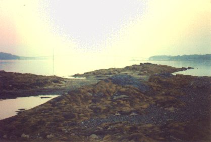
Before I left home, my dad told me about a small shrub covered island called Spectacle Island. I guess when I was five or six, my dad had a small 20-something foot (about 23') sailboat and we stopped at Spectacle Island and looked around.. I remember the sailboat, I think I might just barely remember the island.. I remember some island we stopped at and called it crab beach cause of all the crabs and one pinched my sister's finger... but anyways, dad said there was nothing much good on Spectacle Island.. but since I was passing by, I stopped to check it out... also ate lunch there, and checked my maps and compass against landmarks I could see to figure out exactly where Eggemogin reach was. Spectacle Island is really two small islands that are connected by a sandbar at low tide... prolly where they get their name from.. might remind one of a pair of spectacles or eyeglasses. Both of the islands had small wooded areas of pine. The smaller of the island's pine clumps would have been perfect to camp in, as it contained a wooden platform for sleeping or pitching tents on, and two picnic tables. I got to Spectacle Island at about noon. Had I arrived several hours later (like I would have had I stopped in Castine) I would have camped there. Instead I ate lunch and left.
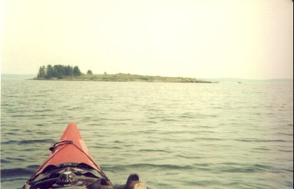 Spectacle island. Looks a lot like Flat Ilsand, but has blueberries and a good place to camp.
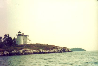 The lighthouse at the eastern side of Eggemogin Reach.
 This was supposed to be a picture of the bridge across Eggemogin Reach... could see it in the photograph but it didn't show up well in the scan. Can see the ends of it if you look really close.
Bad bad thunderstorms were forecast for later in the afternoon, and one blew through at about 6pm... I think I pulled into this spot because I was hungry, then stayed when I heard the thunder.. or I might have been thinking about pulling in and decided it was a really good idea when I heard thunder.. anyways, it doesn't matter.. had a really good thunderstorm for 20-30 minutes. By the time I got my tent set up, it was soaked inside and the worst of the storm had passed. The tent is dried out now, and moved to a better spot. Looks like someone has camped here before. Oh well, it's getting dark and I don't think the ospreys that are nesting nearby like me sitting out here on the rocks. Sounds like someone's having a party on the other side of the reach. It's amazing how well sound carries out here.. the reach is over a mile wide here and I can almost make out what the louder voices are saying, and hear the splash when someone jumps in the water.
I guess I'll be going to bed now so I can get up and be off earlier in the morning than I was this morning.
 Picture taken from the rocky shore near where I camped in Eggemogin Reach. I think this was either right after the storm or before sunset.. I can't remember.
 Another picture of the bridge, this time from near the place I camped.. still can't see much of it.
Wednesday, August 8th, 5:30am
Getting ready to leave.
8:20pm
Had a long day of paddling today... was out of Eggemogin Reach by noon. Turner Island in Eggemogin Reach is a private island owned by some pissy folks who yelled at me when I got out to stretch my legs... and I didn't even get out on the island, stood in knee deep water about a hundred or so feet out in the cove to stretch my legs and refill my 2 liter in-cockpit water supply.. and they yelled at me for instruding on their privacy.. I can understand not wanting to have your idealic privacy invaded by tourists; but the rudeness, almost threatening tone of voice, of the ones who yelled at me.. well, it just made me not like them. After I left, I heard them trying to start the moter on their boat. they tried for a good 20 minutes before I was to far away to hear it.. It's called karma. I could have went back and seen if there was anything I could do to help, but I was really hoping they'd get to spend more time on their private island than they intended to.. and didn't really mind if something bad happened to me later on cause of not helping them.. cause they were very rude people, and I hope they are still there enjoying their private island... they did have a couple little kayaks similar to Oldtown's Otter kayak.. maybe they could get to shore in that..
Tides were perfect today. The tide going out of Eggemogin Reach was with me the entire time. By the time the tide was comming back in, I was out of the reach, and the incomming tide (and winds from the southwest) helped me island hop over to Mount Desert Island, carried me up the western side of MDI, passed Bartlet Island, etc... saw LOTS of seals off MDI, just north of Bartlet Island, and a herd of kayak tourists out for a short daytrip from a boat landing near Bartlet Island to a campground near the bridge from the mainland to MDI
 There are seals in this picture. Four of them. It didn't scan well and only one of them is really noticable... a small black dot.
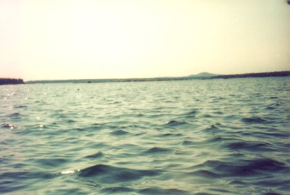
Crossing the northern part of Western Bay, the water got quite rough with three to four foot waves.. the biggest I had paddled in. I think I pulled a muscle in my shoulder, my elbow and wrist both hurt a lot too.. maybe the tendonitis is back. hope not.. I'll try to take it easy tommorow.
I'm camping on the island that's part of the bridge between MDI and Trenton.. in the stinky mudflat area that you always smell as you're crossing over to Mount Desert Island (on the way to Bar Harbot or Acadia National Park). I'm camping right outside a small area of acadia national park.. hoping to get out early in the morning befor the tide goes all the way out... prolly a quarter mile of mudflats here at low tide. There's a road nearby so I'm writing without light.. getting to dark for this so I'm going to bed.
Thursday, August 9th, 1pm
I made it into Bar Harbor about an hour ago.. it's been an interesting day so far. I really really wanted to be off this morning before the tide was out very far.. I even considered getting up at high tide at about 3am and leaving so I could be sure to avoid the low tide mud flats. Sometime after 1am I woke up about every hour to check the tide. I got up and started getting ready to leave just before sunrise. Was pulling out just as the tide was getting down to the flats.. another 10 or 15 minutes and I would have been pulling my boat through the stinky mudflats.
I paddled through the thickest fog I've ever paddled through.. had to stop and listen once in a while to figure out what direction the boat motors I heard in the distance were going.
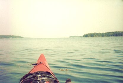
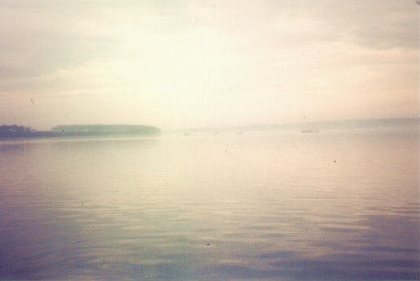 Some fog, and fishing boats in the distance.. On the north-eastern side of Mount Desert Island.