Kayak Trip: Bangor to Camden
~Kayak Trip: Bangor to Camden~
Labor Day Weekend, 2000
So now I'm back in school... Labor Day weekend was coming up and it would be the last long weekend I would have where I could get out and do some kayaking like I had done earlier in the summer, from Pushaw Lake down to Bangor... So I decided to continue my previous trip where I left off a couple months ago.
I left Bangor at a little after noon on Saterday. I wanted to see how far down the river, and possibly, out into the bay I could get before I had to go back to classes on Tuesday.
I didn't think I would get much further than Bucksport before the tendonitis would come back, and rain was forcasted for the entire weekend so I did not know how far I would really want to go... but I left anyways with enough food and supplies for four days (only planned to be out three but I decided I should pack extra in case I got stuck someplace).
I keep sort of a diary when I'm out doing stuff like this. What follows are the entries from my Memorial Day 2000 kayak trip, with other notes written afterwards, and a few pictures.
Trip Down Penobscot River from Bangor
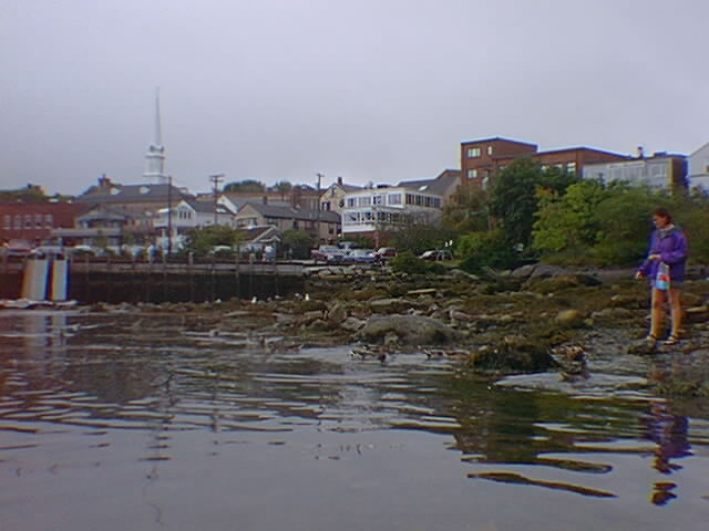
 Leaving Bangor
Day 1, Saterday...
Left from the docks in Bangor at about noon time... nice trip down river so far, went down as the tide was going out. Very overcast most of the day, a little bit of light mist... saw an otter/seal/sea-monster sort of critter several times around winterport. I'm in Bucksport now, well, on the other side of the river, almost accross from the mill. I think I saw part of Fort Knox in the far distance. I might make it to Camden on monday... I'll get to see how the Loon 138 handles in the ocean when it's loaded down with stuff... prolly going to stay close to shore...
Got my tent set up just as it started raining. It's a little cold, kinda wish I would have brought a wool cloak. oh well, time to go sleep for a bit, having trouble writting so it's readable. -time is now 8:30pm.
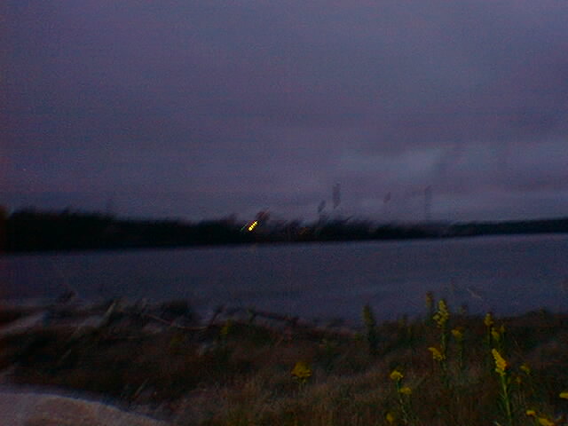
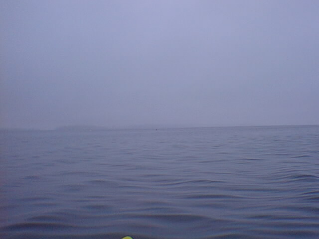
 Winterport in the distance. The small white dot is a large building, part of the marina.
 Pulling in for the night across the river from Bucksport. Pulling a loaded kayak through mudflats is not fun.
 What's on the other shore? This was supposed to be a picture of the mill across the river, with it's nasty smoke plumes but it was a little dark... was not sure how the pic would turn out.
Additional notes:
Between Winterport, Frankfort, and Bowden Point, there is a place called Marsh Bay. The middle of the Bay is rather shallow, less than a foot deep in some places. It was rather odd noticing this... I was just paddling along and the last time I had looked into the water it looked rather deep.. then I look again, about 3/4 mile out, and the water is a foot deep.. that just seemed a little strange to me...
There is a pretty good place to camp on Bowden Point. It's almost right across from the mill... look for a point of land sticking out, built up from large granite blocks.
Day 2, Sunday...
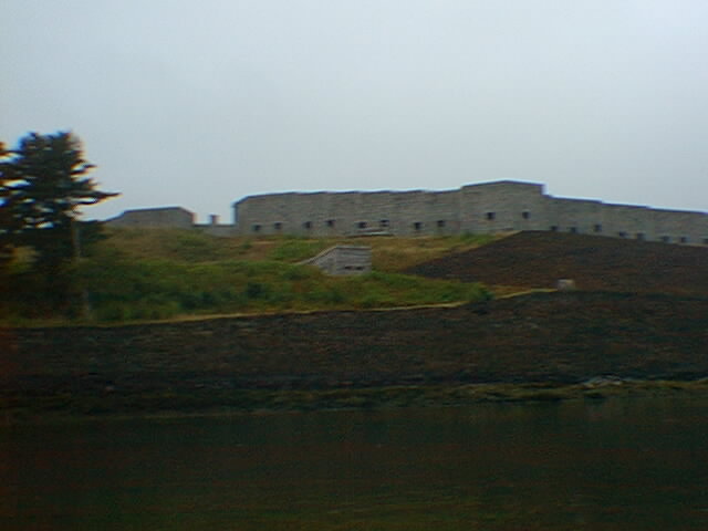 Passing Fort Knox. I bet the lower batteries would have been a fun place to campout in.
Got up at 5:30 or 6:00am cause I noticed the tide was going out again and didn't want to have to drag the kayak back through the mudflats. Rained off and on for most of last night. It's 10:20am right now and I've stopped at Fort Point to take a break. Saw another seal/otter/sea-monster several more times. Sometimes I'd stop paddling for a while and then hear some heavy breathing somewhere behind me. I'd look back and see it looking at me. Looks kinda like a cross between an ugly log and a wet dog.
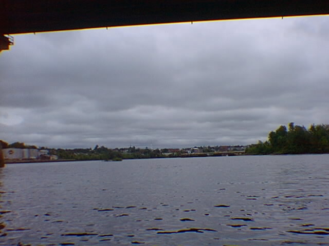
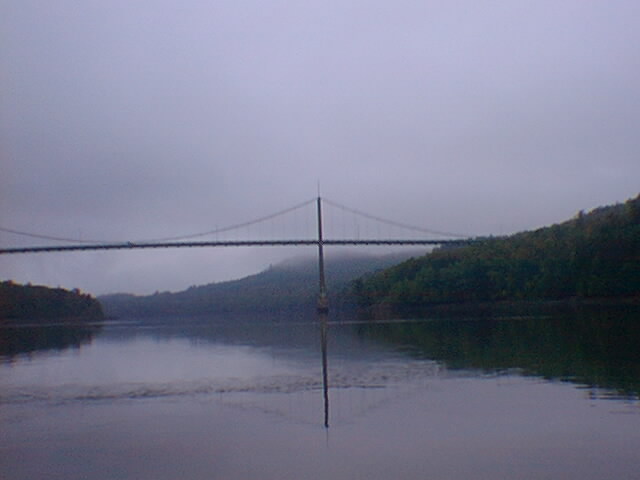 The Bridge to Verona Island ...and some fog.
Day 2, continued...
Time is now 7:44pm. Camping on Flat Island, about a mile offshore from Islesboro and about two miles from the mainland. Did several hours of open water paddling today, decided to cut strait across from Sears Island to another town I could hardly see. It turned out to be Northport. Stopped to take a much needed break and stretch my legs. While there I relized I did not have my wallet in my back pant's pocket anymore, I checked all my other bags and could not find it. I thought it might have fallen out while setting up camp last night or while packing up in the morning.. or when I stopped at Fort Point this morning. oh well. Northport seemed to have crap for camping spots so I decided to paddle out to a small island I could see near Islesboro. It looked good from a distance, not many trees, no large cliffs to be seen, no buildings... The paddle over to it was pretty bad and I was not sure I would make it before dark... only thing to do then was to paddle harder. It was windy and very choppy with some white caps near the end. I made it over in 45 minutes of hard paddling. Hopefully it'll be calm in the morning (and maybe even a wind blowing from the north or east) so I can have an easy and safe trip back to the mainland. Also hope the tide does not come in to far during the night or I might get washed away. Flat Island, like Northport, also seems to have crap for camping spots. What looks like a field from a distance is actually four foot tall bushes and crap. So I get to camp on part of a sand bar, just a couple feet above the high tide line. Time to get some sleep. --8:00pm
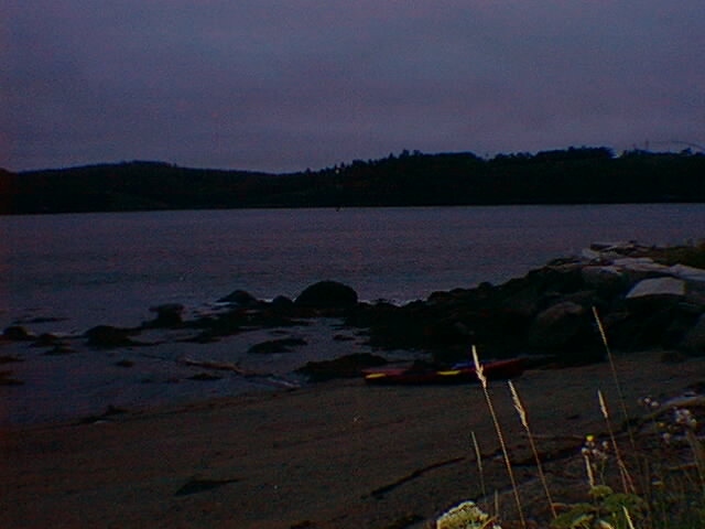
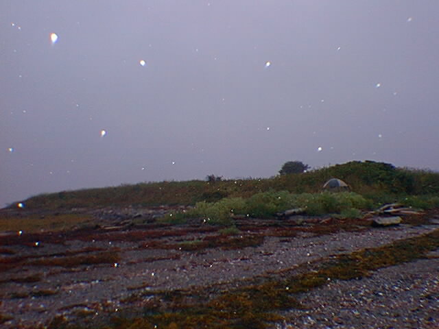 Camping on Flat Island.
Additional notes:
Camping, or even setting foot on Flat Island is not allowed during most of the summer cause it's a nesting place for birds or something. There are several signs on the island that say No Trespassing between certain dates. I can't remember what the dates were... I think it went from May to the end of July.
Day 3, Monday, Labor Day
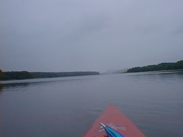
 Two Picures... One was looking behind me at Flat Island and Islesboro, the other was looking towards the mainland.
11:30am, I've made it to Camden... but I suppose I really should start with what went on earlier today. Woke up several times during the night and checked the tide. Highest I saw it was a little more than half way to the high tide line. It rained almost all night again, this time harder than the previous night. Sat around, and slept, in the morning until 7:30 or 8 waiting for the rain to stop. Woke up once and noticed the rain had stopped, went out and looked around... the water was very calm and the tide was on its way out. So I packed up as fast as I could, figuring that if I waited around, the tide might go out to mudflats and later in the morning/day the water might get rough. So I got everything packed up and stuffed in the kayak. It started raining again but it did not last long. It was kinda foggy when I was first pulling away from the island... couldn't see the mainland a couple miles away, could see some of Isleboro, and I could see the light on the ferry dock down in Lincolnville... so I headed for the light. The fog cleared away about twenty minutes after leaving Flat Island but it was still hazy. Ferries make a nice wake. Wish I could have gotten a picture while I passing through it. I was sort of expecting bad weather to come up so everything I did not want to loose if I tipped over was packed way up into each end of the kayak. My map, along with some other stuff which is usually withen easy reach, was in my pack stuffed into the nose of the kayak... So I didn't have access to my map to see exactly how far Camden was after Lincolville. I kept expecting to see it around the next bend. I began to really wonder how far it was, whether it was around the next chunk of land sticking out or if it was behind the one on the horizon much further away. So I started heading into shore so I could dig out the map and have a look... I didn't get far before I saw a big ol' schooner come out from around the next bend... then another one... I sat and watched them until four were headed out towards Islesboro, all a couple minutes apart.. Camden was the only place around here I know of where they had boats like that so I headed strait for that distant section of shoreline. Heading into Camden harbor I met up with a couple in sea kayaks and talked to them for a bit.. they couldn't believe I paddled that far in the bay in the kayak I was in.. and looked at me funny when we first met and I asked if the was Camden we were heading into..
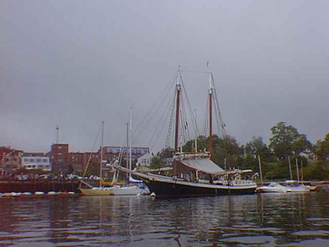
Camden harbor is kinda maze-like. It goes in sort of like the letter "J", with a couple coves and stuff that don't really lead into the part of the harbor near downtown and the public library. End of trip. I called my parents for a ride home... Before I left Bangor they agreed to come pick me up where ever I ended up.
Some more pictures...
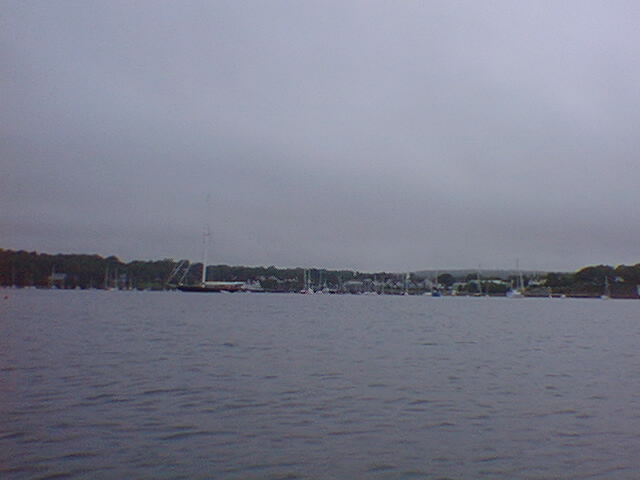
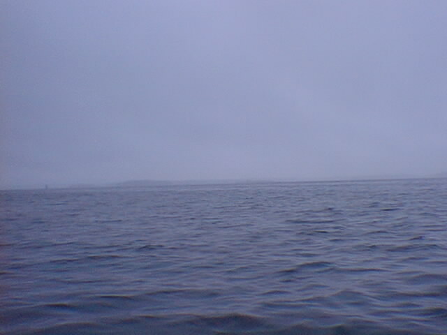
 Must be Camden ahead. I took this pic when I saw the schooners coming out from Camden. There are two of them in this picture... smallish dots on the horizon. The lack of color in this picture really contrasts with how happy I was to see these ships. Its prolly my favorite of all the picture I took during this trip.
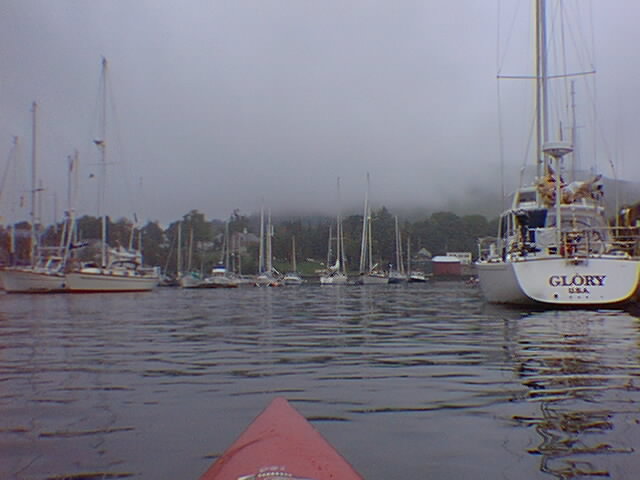
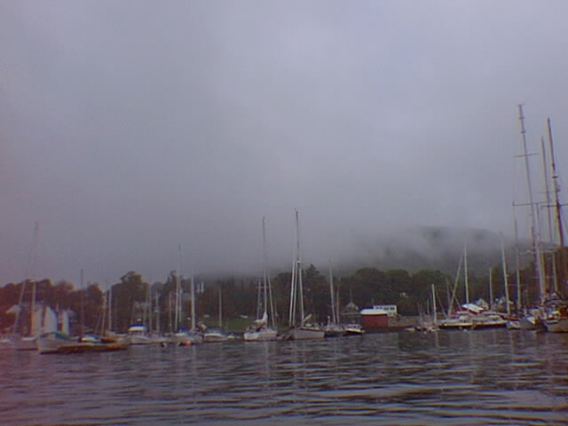
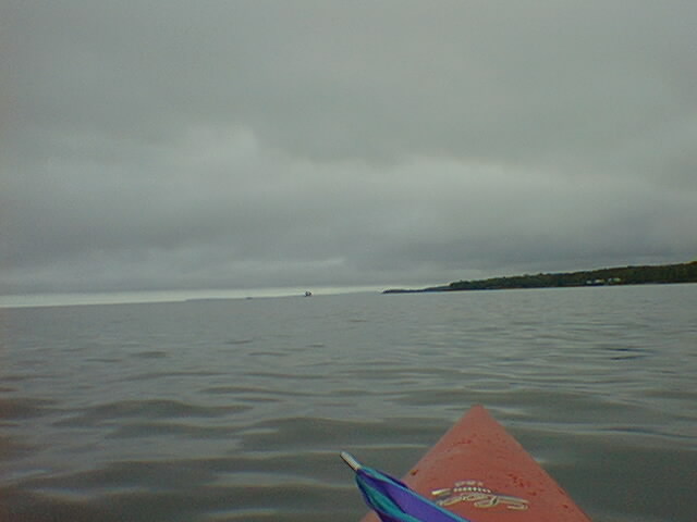
Several pictures of Camden harbor. I like the fog/low clouds in a couple of them... can't even tell the Camden hills and Mount Battie are there... but I like the Hills so the pictures would have been just as good without the fog.